

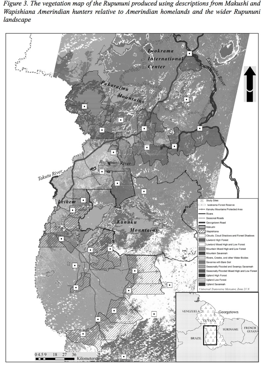
Anthony Ravindra Cummings led the Project Fauna team in the production of a vegetation map for the Rupununi region of Guyana, with the participation of Makushi, Wapichana and other Amerindians. Cummings and co-authors Jane Read (Syracuse University, USA) and Jose Fragoso state that with hunter’s vegetation descriptions and remotely sensed imagery we produced an eleven-class vegetation map that covered the main vegetation types described by hunters. “The final map shows that indigenous hunters can be important partners in the map-making process…”.
Full article:
